


Coastal aerial survey for climate change studies begins in mid-July
An aerial survey of the James Bay and Hudson Bay coastlines will begin in a few weeks.
This is in connection with the Climate Resilience project announced in late May.
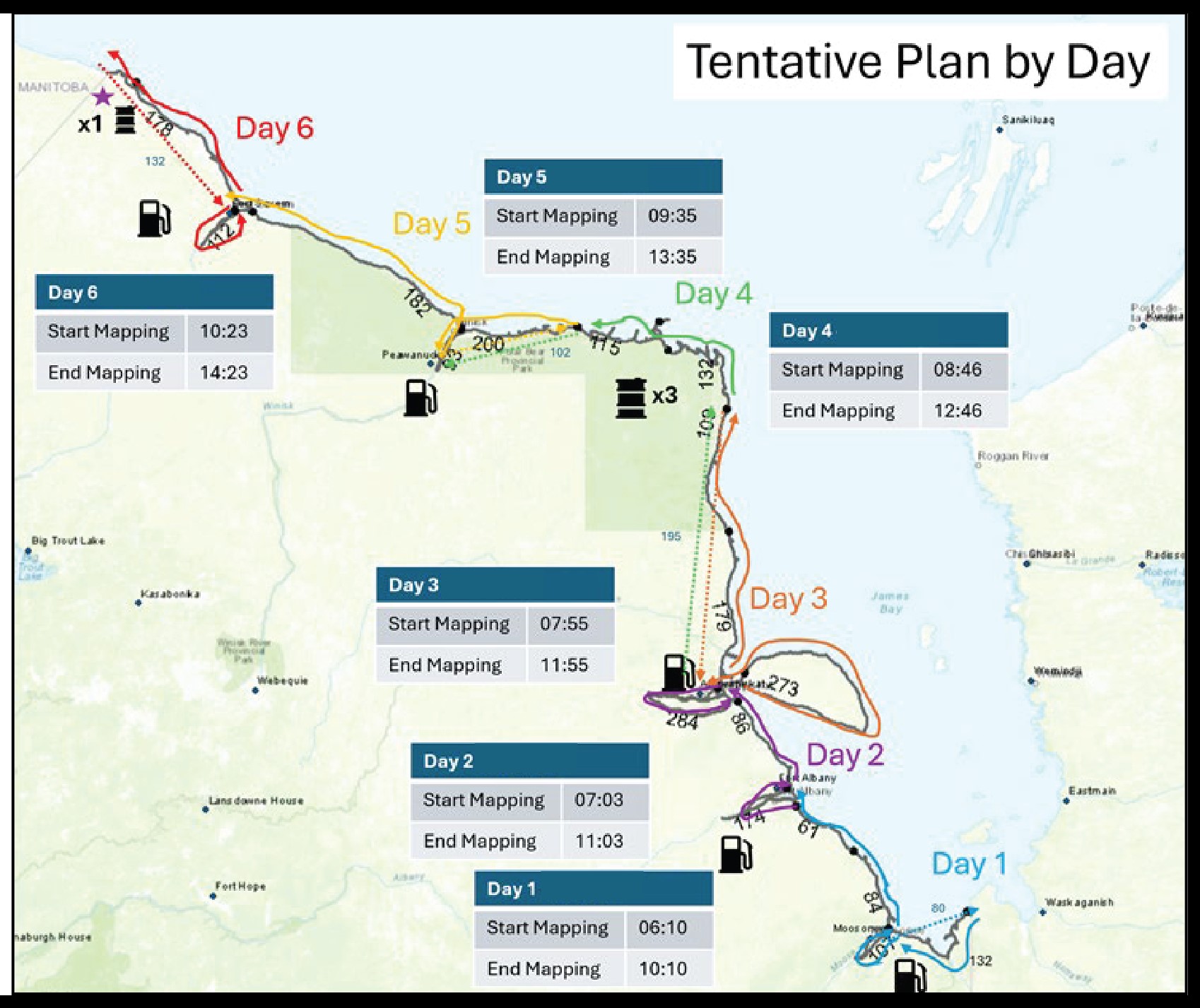
A Bell 206 LongRanger helicopter is being utilized and will do a single run, taking video and photos of the James and Hudson Bay coasts starting from the Quebec border and ending at the Manitoba border.
Six days in mid-July have been allocated to complete the aerial survey.
Those involved with the research project are hoping to have the helicopter in the air from July 11 to 16, though these dates are tentative because flights will depend on weather conditions.
Mushkegowuk Council’s Cree Geomatics department is part of the team spearheading the Climate Resilience project in partnership with Mushkegowuk’s Lands & Resources department, Environment & Climate Change Canada, as well as Up North On Climate of Laurentian University.
Environment and Climate Change Canada is providing the technical expertise to collect the video and the photographic information from the helicopter platform — something the federal department has done along coasts of other parts of Canada, for other research projects.
The images collected next month of the James Bay and Hudson Bay shorelines will then be compared with historic satellite imagery, some dating as far back as the 1970s.
Roxanne Metlin, Climate Resilience Coordinator with the Cree Geomatics department of Mushkegowuk Council, said the images will reveal the composition of different stretches of the shoreline as well as physical changes caused by erosion over the years.
She said a key objective in collecting this information is to help Omushkego communities create their own adaptation plans related to climate and coastal changes.
Dr. David Pearson, environmental professor at Laurentian University, added, “We know the coast and tidal flats are changing because the land is rising by as much as a metre in the lifetime of an Elder. That’s why there are about 200 beach ridges marking old, raised beaches as old as 7,000 or 8,000 years ago.
“We’re looking at the results of something that is happening, not speculating or looking for a needle in a haystack.”